
286. Nerrina Historic Area and Glen Park State Forest 10.9km
U3A Hike No 286

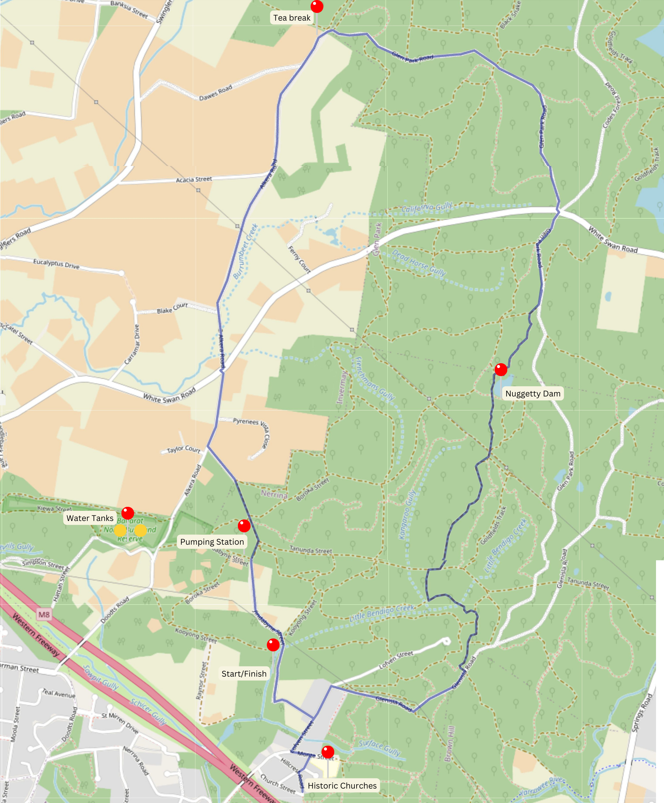
A group of sixteen walkers met in
Lofven St then drove down the dirt road of Deveson Lane to park on the side of
the road. It was the largest gathering for many months, perhaps the sign of New
Year resolutions? Sharon and Deb were among those welcomed to join the intrepid
explorers.
We started by walking back up Lofven then turned into Monte St to the start of the Nerrina Heritage area. The name Nerrina apparently derived from an aboriginal word, and was known as Little Bendigo for a time, when gold miners were returning from Bendigo.
The Little Bendigo primary
school remains, and though not surrounded by houses, has continued in a rather
handsome building. It was originally established as an Anglican school in 1858,
until taken over by the Education department in 1874 after the Education Act
stopped funding to denominational schools.
Around the corner in Monte St
stands the well-preserved St James Church of England building (Est 1864), now
in private hands. A little further on the old Methodist church has gone to
ruin, retreating into bush.
We retraced our steps to return to Lofven St before turning into Glenisla Rd and off towards the Glen Park State Forest. We joined the Goldfields Track on a winding route that took us up and down through native bush and along the western wall of Nuggety Dam. Sadly, no time for fishing, so we continued along to Glen Park Rd then crossed the White Swan Rd at five-ways (yes, 5 roads join here). Glen Park road is at this point a gravel dirt road with the Creswick pine plantation on the right, and gold-mined bush on the left. Several Km further on it reaches a T-intersection with Alkera Rd, just the spot for morning tea.
The overcast day quickly threatened to drip rain so we turned south along Alkera, through more open farm lands with some rather large houses now on the expanding edge of Ballarat. Crossing White Swan Rd again, we headed uphill and turned left on to Tanundra St, no better than a winding dirt track. But it passed the pumping station along the pipeline shifting water from the White Swan reservoir to the Water Tower on the top of Brown Hill. The things you find that you don’t know about! We joined Jindabyne St and were soon back at the cars.
Thanks to Jan for leading us, and the Andrew/Gordon team for the walk concept!
Photos by Andrew Parker


Comments
Post a Comment