
Wolfes Rd - Bush Inn Rd, Creswick Regional Park Circuit - 9.9 Kms

Hike Report by Jan
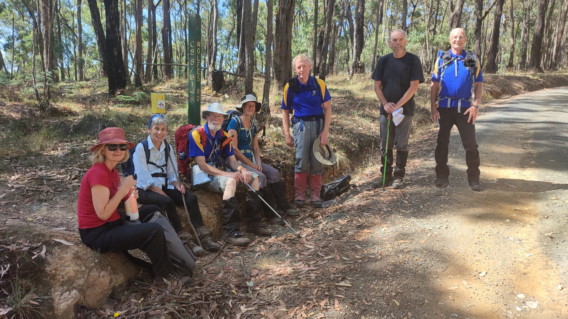
Seven of us went in two cars to our starting point along
Wolfes Road in the Creswick Regional Park.
It was a gorgeous day for hiking – sunny with a bit of a breeze and
tracks mostly shaded by tall trees. The
hike went along bush tracks, rough 4WD tracks and unsealed roads and featured
the usual array of short steep hills, gentle undulations and welcome flat
bits.
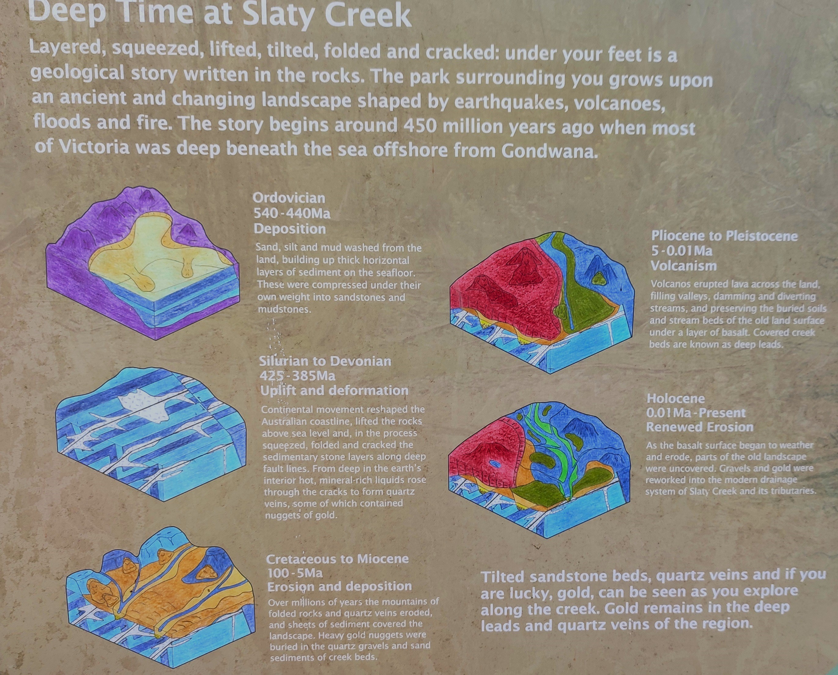
We noticed lots of sluicing, lots of piles of quartz stones
and rocks, lots of land turned upside down, lots of water races (including two
running parallel belong to rival water supply companies) and lots of mine shafts. And lots of Cherry Ballart trees too. Did you know that the Cherry Ballart was
considered by the Wadawurrung to be “men's tree” because, remarkably, its seeds
appear on the outside of edible fruit?
This makes it a very convenient fruit to eat because it can be held by
the miniature green olive like seed while the lustrous cherry coloured fruit is
bitten off [Wikipedia].
At one of our stops to catch our breath, Gordon gave us a
condensed but interesting version of the techniques of mining for gold, starting
with the most simple and finishing with the more complicated and costly.
At a three-way intersection of paths, it was amusing to see
two GPS devices give the way to proceed forward in two opposite
directions. Mark’s device and Gordon’s
map won, and we turned left instead of right.
We met a detectorist fellow and his friendly dog at Slaty
Creek Picnic Area Number One. His
accommodation, if he was only staying for a couple of days, was his station
wagon which had a mattress in the back as well as all his other gear. He said it was surprisingly comfy and cosy,
but he had to turn himself into a pretzel to get in and out of it!
We were really interested to see that the three creeks,
which the last time we walked this route had been either too deep to cross and
had to be detoured around (Cotty Creek), waded through with pants rolled up and
socks and boots off (Slaty Creek) or crossed upstream over a fallen log, were
totally dry this time. Joan could not
help herself and just had to go and walk across that log again.
When we lined up for the group photo, there was some very
silly talk about including a “Where’s Wally (Andrew)” feature in the picture,
utilising Andrew’s photoshop skills.
As we ate our lunch back at the cars, Andrew demonstrated
his new miniature torch with its multi-coloured lights. Particularly impressive
were the blue and red flashing lights reminding us of a police car. He also demonstrated the deliciousness of his
Anzac biscuits by dividing his last one into small pieces for us to taste.
I think my favourite visual part of this walk was along the
Goldfields Track section as the low grasses and undergrowth vegetation were
green in the dappled shade, unlike my own grass at home which is very brown and
crisp.
It was lovely to get out into the bush, hear some
kookaburras and chat with some very nice people. Thanks Gordon, for making it happen.
Photos by Andrew


How many of you finished the hike? That wolf looks fierce and hungry! And yes, found the wombat, eventually. Good fun.
ReplyDeleteSounds like a great time was had. Sorry I couldn't get there. Also noted the sharpness of the photos - is it a phone or camera upgrade?
ReplyDelete