
Five Ways - Ditchfield - Nerrina Historical Area Circuit - 12 Kms
U3A Hike No. 179

Hike Report by Martin
It was a small group
for our first non-core hike for 2022, we numbered seven, including our leaders
Gordon and Andrew. Our starting point
was a small parking area at the intersection of White Swan and Glen Park Roads
(south side).
Once loaded up with our
packs and provisions, and after our pre-hike briefing, we set off south along
Glen Park Road for a short distance, then veering off to the right along a
vehicle track which linked up with another track that took us west towards
Frenchman’s Gully. Along the way we
noticed a number of historical water channels (races) that crisscrossed the
area and was possibly used to supply water to the sluicing operations at
Frenchman’s Gully. The evidence of the
impact of the sluicing could be easily seen on arrival at the gully of the
Frenchman.
Gordon had warned, as
part of the pre-hike briefing, that this area was heavily favoured by “mountain
bike” riders and as we continued south along the track, we could see evidence
of this through the abundance of high jumps and sharp bend mounds that required
significant engineering and labour.
Throughout this section of the hike, we also spotted numerous shafts
very close to the track, some of which were quite deep.
We continued on past
Jenkins Gully to Boroka Street and then onto Tanunda Street, through Kangaroo
Gully, continuing on until we picked up the Goldfields Track and then a series of
other tracks that took us past Surface Gully and Sheepskin Gully down some
steep inclines, back on to Goldfields Track and closer to our Morning Tea
destination - Ditchfield Bushland Reserve.
By now the mercury had
begun to climb and the opportunity for a rest break and refreshments was
embraced by all. Finding a shaded place,
we settled in and enjoyed our refreshments.
For our return trip, we
left the reserve via Ditchfield Lane, heading north and quickly picked up the Goldfields Track and after a steep climb along the a well eroded track that
blackberries had invaded, we came across a track - one of many, courtesy of the
mountain bike riders - heading east. Fortunately,
Gordon had planned well and knew which one we needed to follow as we headed in a
northly direction, over fallen trees, across a number of water races, until we
reached a massive Water Main that was undergoing a repaint.
A quick chat with the
guy on the elevated work platform charged with the job of applying the paint,
we continued on to cross over Glenisla Road and then Glen Park Road. Back on to Goldfields Track, north towards the
“transmission lines” and then Nuggety Dam.
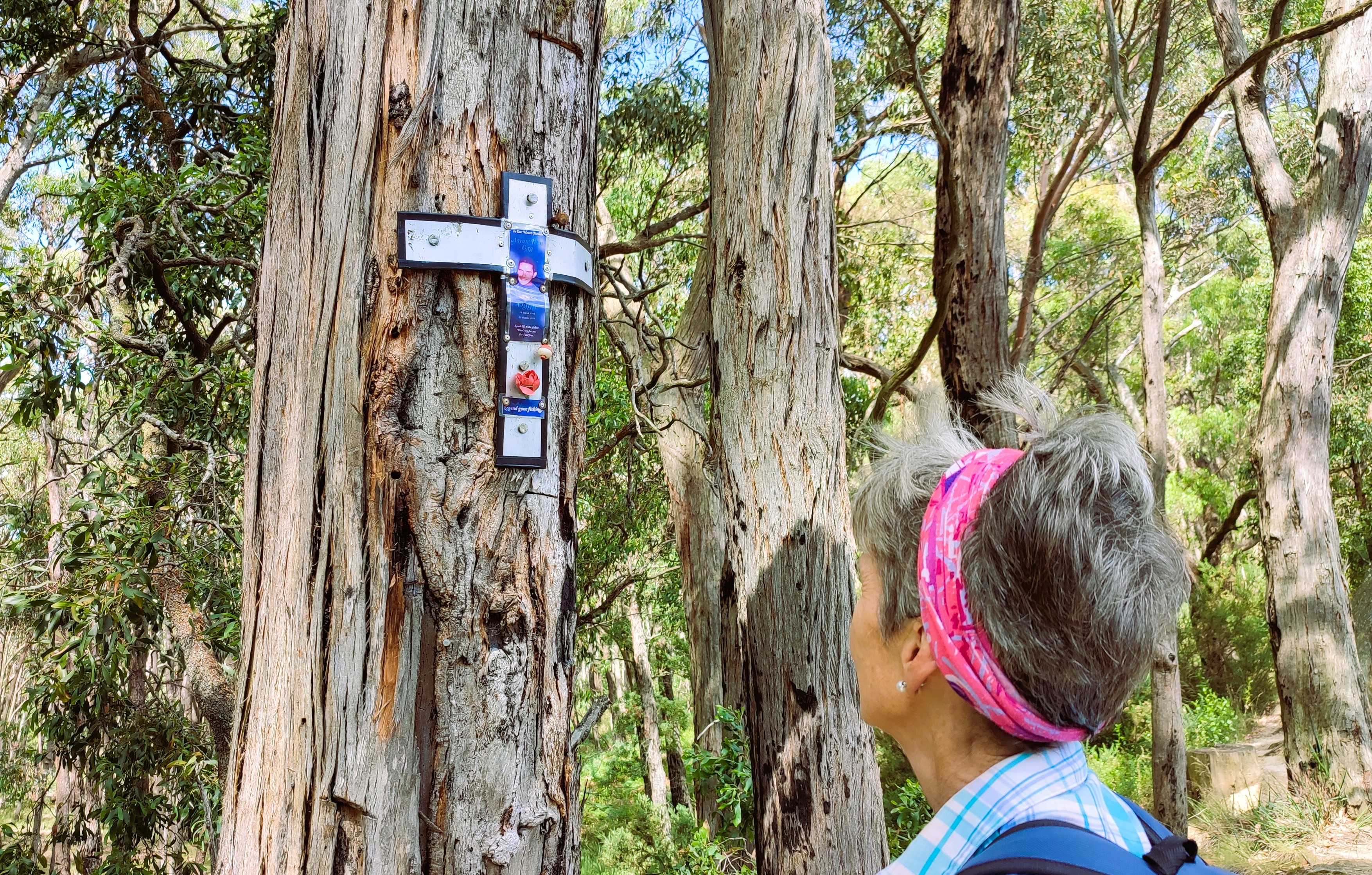
We paused at the dam to reflect on a memorial for a young fisherman that
was taken too early. After the customary
group photos we continued north along the Goldfields Track, back on to Glen Park
Road, arriving at our destination shortly thereafter.
Time to head home for a
shower and a cold drink – or two.
This hike lived up to
Gordon’s promise. It was hilly, not too
much but enough to test our fitness levels.
A variety with 4WD tracks, walking tracks and mountain bike tracks to
navigate. A variety of bush habitat with
the occasion colourful bloom. And of
course, great company.
On behalf of the group,
thank you Gordon and Andrew.
Photos by Andrew


Comments
Post a Comment