Canadian Wilderness: Canadian and Mt Clear Circuit - 15 Kms
Hike Report by Anne
10 walkers met at Canadian to begin an exploration of the
Whitehorse Ridge, led by mining enthusiast Gordon. Newly released from another
lockdown, it was great to be walking as a group again. We crossed Main Road and
headed into the pine forest wasteland south of Elsworth Street. This area has
been christened “Mattress Mine” by the New Chums class, due to the amount of
household waste dumped in the area. We were agreeably surprised to see that
some large scale cleaning up of the area was occurring, with gorse,
blackberries and rubbish removed from the area nearest Elsworth Street.
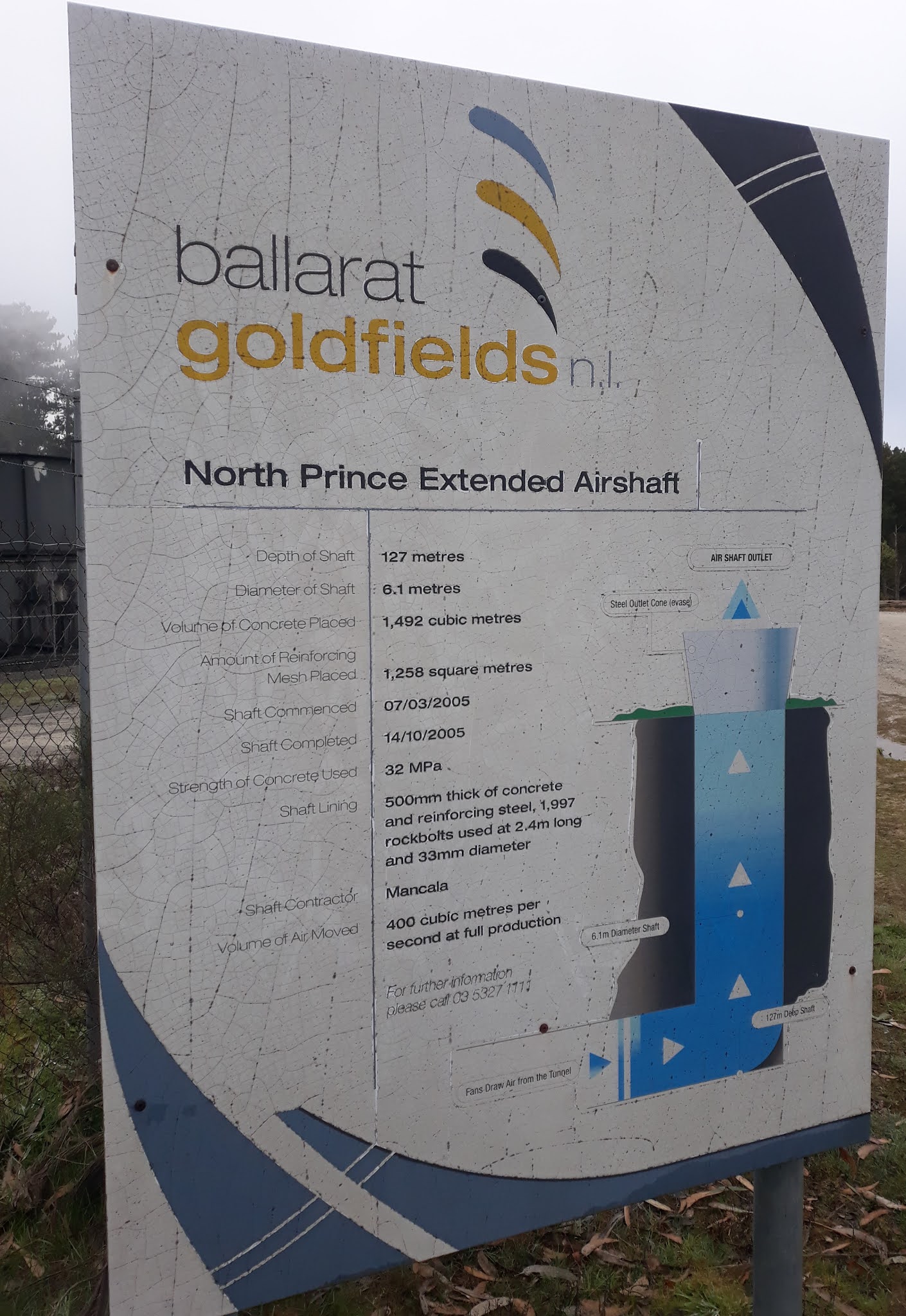
We stopped to look at the North Prince Extended airshaft – a
former quartz mine shaft now being used to draw air from the Ballarat
Goldfields mine. This mine was one of many quartz mines dotted along the
Whitehorse Ridge during the 1870’s to 1900, following the indicator bands of
dark slate and quartz that pointed to the presence of gold. Wandering on
through the pine trees, mullock heaps, brick structures from past mines and
household waste, we emerged onto Tinworth Avenue.
Crossing over, Gordon led us into an almost invisible track,
that led to a hidden hut complete with a letter box. We wondered about who had
built this fairly substantial structure, with its large bar set into one side
and drug references painted around the walls. We crossed Indicator Lane and set
off into the pine and scrub again until we met the fence line of Ballarat
Goldfields. We followed the fence line, passing a water tower then reaching a
high point that offered great views over the tailings dam of the mine, the
Sebastopol plateau and the land beyond it.
South of Whitehorse Road we walked along a muddy track called
Bradleys Lane, which wandered through a pine plantation. Our shoes were getting
heavier as we squelched on through the mud, but one of the group found a novel
way to wash off the mud by slipping into a fairly deep puddle. By this stage
our thoughts were turning to morning tea, so we found a pine glade with needle-covered
mounds to relax on.
Bradleys Lane intersected with Frenchmans Lane to lead us
back onto Whitehorse Road, where two wedgetail eagles were spotted circling
overhead. At the bottom of the hill, we joined the Yarrowee Trail heading back towards
the city. Passing the Ballarat South Sewerage Works, we found the northern
fenceline of Ballarat Goldfields and headed uphill to Brittain Street, completing
a circumnavigation of the Goldfields Mine area. We came out opposite Mattress
Mine, the area we had wandered through earlier in the day, and retraced our
steps back to the starting point at Canadian.
It was a very interesting walk, through areas many of us had
never been before. Despite feeling that we were in the wilderness, we were
never very far from surburban Ballarat. If the area were cleared of dumped
rubbish, it could become a great recreational asset for Ballarat.


Really enjoyable report Anne
ReplyDelete